
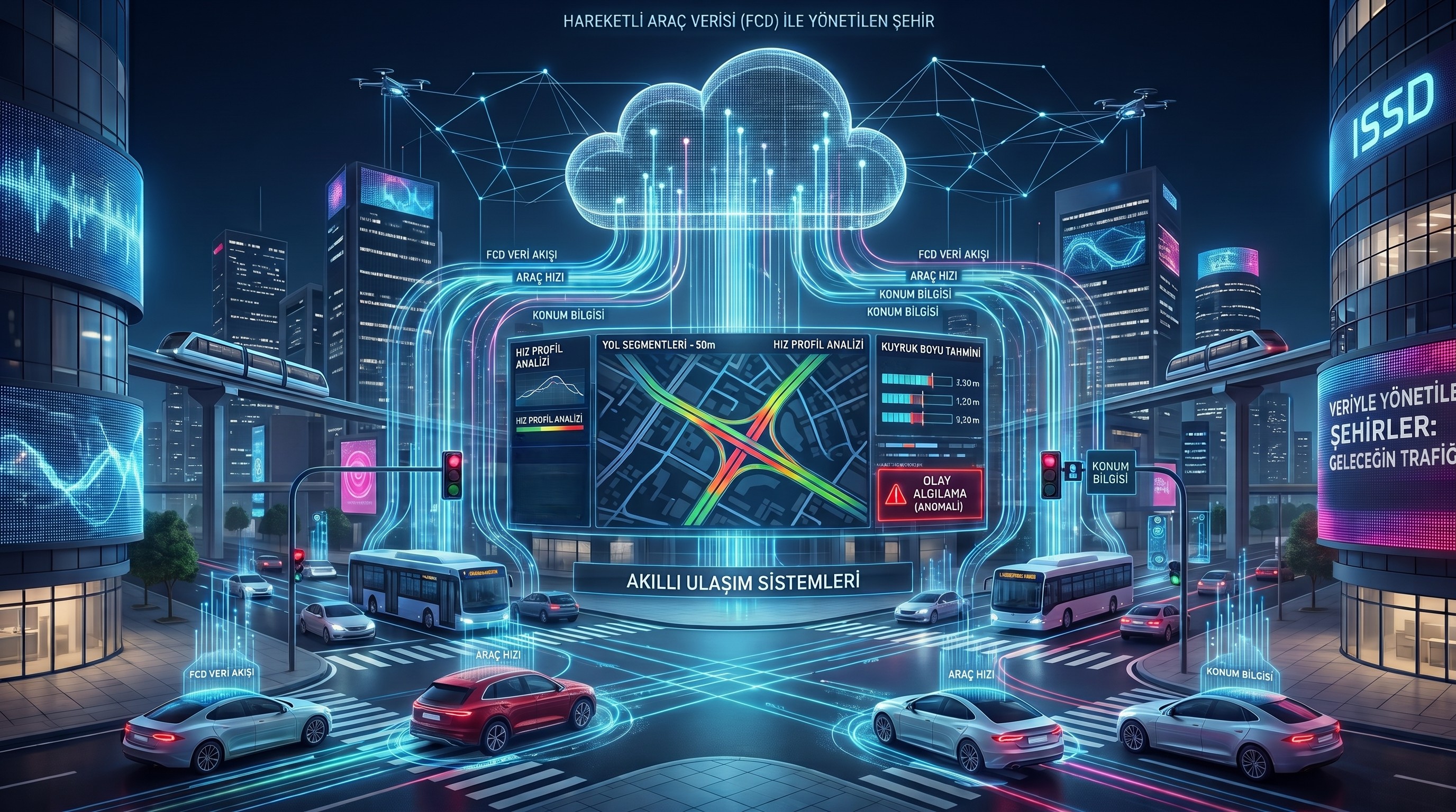
Floating Car Data (FCD) refers to a comprehensive data pool generated through the collection of speed and location information from vehicles traveling within the traffic network. This technology enables traffic analysis and management to become significantly smarter, more dynamic, and more efficient. Unlike traditional traffic monitoring systems, Floating Car Data (FCD) largely eliminates the need for continuously deploying additional physical sensors across the infrastructure. Collected
through GPS-enabled devices and in-vehicle tracking systems, this data is typically processed by dividing road networks into 50-meter segments. Signals received from each road segment within urban areas at intervals of approximately one minute are fully anonymized and analyzed at data centers. In Intelligent Transportation Systems (ITS) projects implemented across Türkiye, this data plays a critical role in intersection management and transportation master planning.
A wide range of highly technical analyses can be performed on these large-scale datasets. Among the most important are Speed Mapping and Speed Profile Analysis. For defined time intervals such as 15-minute, hourly, or daily periods; the minimum, maximum, and average speeds across road segments are mapped to generate a heat map. These visualizations can be structured with time on the x-axis and segment distance on the y-axis, enabling the rapid identification of bottlenecks and recurring congestion patterns along major traffic corridors. Another key methodology involves the application of Congestion Index Analysis and the associated Peak Hour Analysis. The precise start and end times of peak hours during which
morning and evening traffic intensifies across various regions of the city are meticulously identified according to seasonal variations (such as summer periods, winter periods, or official holidays). Consequently, urban public transit service frequencies, bus route configurations, and intersection signal timing plans are directly optimized utilizing Floating Car Data.
In particular, Queue Length Estimation and Queue Length Profile Analysis are essential for maximizing efficiency at signalized intersections. By comparing the entry speeds of vehicles on intersection approach lanes against predetermined threshold values, queue lengths are calculated in meters. This data is utilized to identify the spillover effects between adjacent intersections, internal intersection blockages, and traffic discharge issues. Modern infrastructures, such as Dynamic Intersection Control Modules, employ specialized management systems that synthesize camera-based analytics with Floating Car Data (FCD).
Based on the calculated queue lengths, the system automatically transitions between coordinated and isolated intersection management modes. To analyze not only real-time conditions but also historical data in detail, Historical Route Analysis and Segment Analysis are implemented. Through Origin-Destination (O-D) Matrices, which accurately reveal the exact origin and destination of traffic traversing a given segment, travel times are calculated with a high degree of reliability. For unforeseen occurrences such as traffic accidents or sudden decelerations, Incident Detection algorithms are deployed. Within this diagnostic framework, advanced statistical techniques such as Analysis of Variance, F-Test and time-series Anomaly Detection are utilized to instantaneously identify abnormal variations in queue lengths, transmitting them as emergency alerts to central traffic operators. In conclusion, Floating Car Data (FCD) represents one of the most innovative and scientifically
grounded approaches to addressing complex traffic challenges in today’s rapidly expanding urban environments. In-depth analyses derived from this rich data repository reduce traffic accidents, minimize delay times, and significantly enhance driving comfort. Furthermore, by mitigating unnecessary stop-and-go driving, it prevents hundreds of tons of carbon emissions and yields substantial fuel savings. Basing transportation management decisions on concrete,
real-time big data analytics rather than subjective observations constitutes an invaluable asset for the smart cities of tomorrow.