PTV Software
PTV Group software are professional transportation planning solutions used for modeling transportation networks, simulating traffic flow, planning public transport systems, analyzing pedestrian movements and carrying out traffic engineering studies.
These tools can be used by transportation planners, traffic engineers, municipalities, public institutions, consulting firms, universities and managers of large-scale facilities to support transportation decisions with technical data.
The World’s Leading Transportation Planning Software
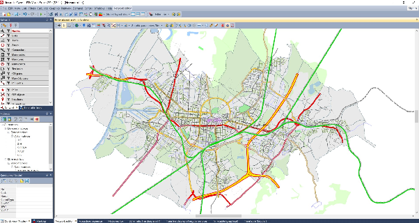
PTV Visum is transportation planning software that enables the modeling of transportation networks and transportation demand at a macroscopic scale.
It can be used to build transportation systems at the city, regional or national scale; to model travel demand, plan public transport systems and compare different transportation scenarios.
With PTV Visum, transportation models can be prepared that provide data for long-term strategic planning as well as for short- and medium-term operational assessments.
What Is PTV Visum?
PTV Visum is macroscopic transportation modeling software that combines different data sources — such as the road network, public transport network, population, employment, travel demand and travel behavior — within a common model. With the software:
- The existing transportation network can be modeled.
- Travel demand can be generated.
- Origin-Destination matrices can be prepared.
- Vehicle and trip distributions can be calculated.
- Public transport lines can be evaluated.
- New transportation investments can be compared.
- The potential impacts of road and public transport projects can be examined.
- Long-term transportation strategies can be developed.
How Does PTV Visum Work?
- 1The road and public transport network is imported into the model.
- 2Analysis zones are defined.
- 3Population, employment and land-use data are added to the system.
- 4Trip production and attraction values are generated.
- 5Origin-Destination matrices are prepared.
- 6The distribution of trips across transport modes is determined.
- 7Trips are assigned to the road and public transport network.
- 8Traffic volumes, travel times and network performance are calculated.
- 9Different investment or transportation policy scenarios are compared.
- 10Results are presented with maps, tables, charts and reports.
PTV Visum Use Cases
PTV Visum Modules
Benefits of PTV Visum
- Builds a transportation model at the city and regional scale.
- Evaluates road and public transport systems within a common structure.
- Supports forecasting of future transportation demand.
- Enables comparison of different investment options.
- Makes the potential outcomes of transportation policies visible.
- Supports evaluation of public transport lines and service levels.
- Provides the technical basis for transportation master plans.
- Supports long-term strategic decisions with data.
Multimodal Traffic Simulation Software
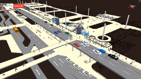
PTV Vissim is multimodal traffic simulation software that simulates the movements of different road users — such as cars, public transport vehicles, heavy vehicles, cyclists and pedestrians — at a microscopic level.
The software treats each vehicle and road user as a separate simulation object. In this way, junctions, road corridors, public transport systems and complex transportation areas can be modeled in detail.
PTV Vissim can be used to evaluate the performance of existing transportation systems and to test different traffic arrangements in a virtual environment before implementation.
What Is PTV Vissim?
PTV Vissim is simulation software that reproduces traffic movements at a microscopic scale. In microscopic simulation:
- Each vehicle is modeled individually.
- Vehicles’ acceleration and deceleration behaviors are defined.
- Lane-changing movements are simulated.
- Driver behaviors are evaluated.
- Traffic lights are added to the model.
- Public transport and pedestrian movements can be shown together.
How Does PTV Vissim Work?
- 1The road network and junction geometry are created.
- 2Lanes, turns and connections are defined.
- 3Vehicle types and traffic volumes are added.
- 4Driver behaviors are set.
- 5Traffic signal programs are imported into the model.
- 6Public transport lines and stops are defined.
- 7Pedestrian and bicycle movements can be added to the system.
- 8The simulation is run with different traffic scenarios.
- 9Queue, delay, travel time and vehicle throughput data are calculated.
- 10Scenarios are compared through performance indicators.
PTV Vissim Use Cases
Analyses Produced with PTV Vissim
Benefits of PTV Vissim
- Enables transportation projects to be evaluated before implementation.
- Shows complex traffic movements in detail.
- Models vehicle, public transport, cyclist and pedestrian movements together.
- Supports measurement of junction and corridor performance.
- Enables comparison of different traffic scenarios.
- Makes the potential effects of traffic arrangements visible.
- Presents simulation results numerically and visually.
- Provides technical data for congestion and emission studies.
Realistic Pedestrian Simulation Software
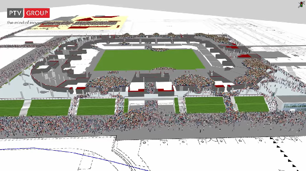
PTV Viswalk is pedestrian simulation software that models pedestrians’ movements and their interactions with one another at a microscopic level.
The software enables the evaluation of pedestrian movements on walkways, crossing areas, waiting zones, stations, terminals, airports and event venues.
With PTV Viswalk, pedestrian densities, crossing times, waiting areas, bottlenecks and evacuation scenarios can be examined in a virtual environment.
What Is PTV Viswalk?
PTV Viswalk is pedestrian mobility software that models each pedestrian as a separate simulation element. Pedestrians’:
- Walking speeds
- Route preferences
- Interactions with one another
- Movements in high-density areas
- Waiting behaviors
- Entry and exit movements can be simulated in detail.
How Does PTV Viswalk Work?
- 1The geometry of the area to be analyzed is created.
- 2Pedestrian entry and exit points are defined.
- 3Pedestrian demand and movement directions are added to the system.
- 4Walking areas, crossings, stairs and waiting zones are defined.
- 5Pedestrian movements are simulated microscopically.
- 6Density and travel times are calculated.
- 7Bottlenecks and high-density areas are identified.
- 8Alternative design or operating scenarios are compared.
PTV Viswalk Use Cases
Analyses Possible with PTV Viswalk
Benefits of PTV Viswalk
- Makes pedestrian movements visible in detail.
- Identifies areas where high density may occur in advance.
- Enables evaluation of the adequacy of waiting areas.
- Supports examination of pedestrian crossings and corridor widths.
- Enables evacuation scenarios to be tested in a virtual environment.
- Provides data for improving pedestrian safety and comfort.
- Allows comparison of different architectural and operating scenarios.
All-in-One Traffic Engineering Software
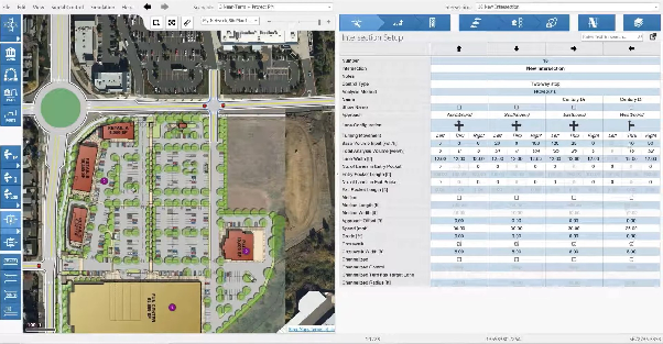
PTV Vistro is traffic analysis and scenario management software developed for traffic engineers and transportation planners.
It enables the analysis of road networks consisting of signalized junctions, unsignalized junctions and roundabouts. Traffic impact assessments, junction capacity analyses and signal studies can be carried out within a single software environment.
PTV Vistro supports analysis and reporting processes using accepted traffic engineering methods such as the Highway Capacity Manual.
What Is PTV Vistro?
PTV Vistro is traffic engineering software that enables the evaluation of junction and road network performance with analytical methods. Through the software:
- Signalized junctions can be modeled.
- Unsignalized junctions can be analyzed.
- Roundabouts can be evaluated.
- Traffic volumes can be entered into the system.
- Junction delays can be calculated.
- Levels of service can be determined.
- Signal timings can be evaluated.
- Traffic impact analyses can be prepared.
- Scenarios can be compared.
- Automatic reports can be generated.
How Does PTV Vistro Work?
- 1The road network and junction geometries are created.
- 2Traffic volumes and turning movements are entered into the system.
- 3The junction control type is determined.
- 4Signal programs and timings are defined.
- 5Capacity, delay and queue calculations are performed.
- 6The existing situation is analyzed.
- 7New project or development scenarios are added.
- 8Different arrangement options are compared.
- 9Results are presented with automatic reports.
PTV Vistro Use Cases
Highlights of PTV Vistro
Benefits of PTV Vistro
- Combines traffic engineering analyses in a single software.
- Evaluates junction performance with standard methods.
- Enables comparison of different project scenarios.
- Facilitates the preparation of traffic impact reports.
- Reduces working time thanks to automatic reporting.
- Supports the reduction of data-entry and calculation errors.
- Provides the technical basis for junction and road network decisions.
Where is the PTV software family used?
Which PTV software for which need?
Frequently Asked Questions
What is the difference between PTV Visum and PTV Vissim?+
PTV Visum performs macroscopic transportation modeling at the city and regional scale. PTV Vissim, on the other hand, models vehicles and road users individually to simulate junctions and corridors at the microscopic level.
What is PTV Viswalk used for?+
PTV Viswalk is used to model pedestrian movements, densities, waiting times, bottlenecks and evacuation scenarios.
What analyses does PTV Vistro perform?+
PTV Vistro is used for signalized, unsignalized and roundabout analyses, capacity calculations, level-of-service assessments and traffic impact studies.
Can PTV Visum be used in public transport planning?+
Yes. Public transport lines, stops, service frequencies, transfers and passenger movements can be modeled.
Can PTV Vissim simulate pedestrians and cyclists?+
Yes. Alongside vehicle traffic, pedestrian, cyclist and public transport movements can be evaluated within the same model.
Do PTV software analyze the current situation or future scenarios?+
They can analyze both. The current situation can be modeled, then new road, junction, public transport or traffic regulation scenarios can be created and the results compared.
Which software is suitable for transportation master plans?+
The core software for transportation master plans and long-term strategic modeling studies is PTV Visum.
Which software is suitable for junction simulation?+
PTV Vissim can be used for visual and numerical examination of detailed vehicle movements; PTV Vistro can be used for standard traffic engineering calculations.
Which software is suitable for evacuation analysis?+
PTV Viswalk can be used for pedestrian evacuation scenarios and the analysis of high-density pedestrian areas.
Evaluate PTV software in your project
Let's determine together with our technical team which software fits your needs.